Infrastructure Data
Presented below is our interactive charging infrastructure data dashboard, covering non-domestic chargers on the island. Use the available filters to focus on what data is of interest to you. Several View Modes are available:
- County. Number of operational connectors per county.
- Location. Number & density of operational connectors by actual location.
- Stats. Analysis of number & speed of operational connectors.
- Upcoming. Number of additional connectors planned (i.e. not yet operational) per county.
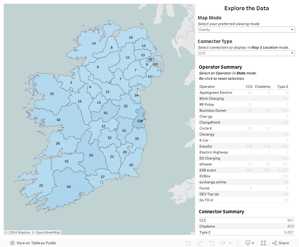
Data source: Open Charge Map
Information pertaining to domestic charging infrastructure is available separately on SEAI's Local Authority Climate Action Plan Dashboard, which reports the number of Home Charger Grants issued per local authority area.